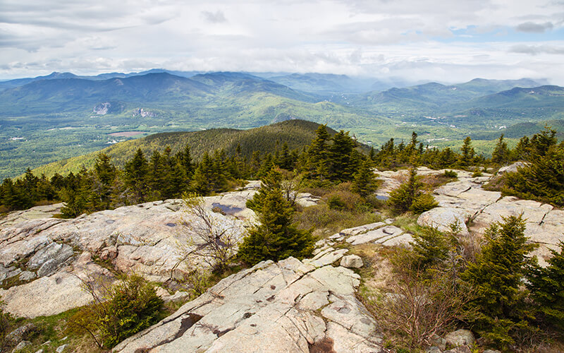
The moderate climb to Mount Kearsarge’s summit offers stunning views of Southern New Hampshire and is among the best hikes in Southern New Hampshire.
Excerpted and adapted from the Southern New Hampshire Trail Guide and Map, 5th ed.
The trails in southern New Hampshire offer great variety, from easy strolls along the seacoast to strenuous trips ascending the bare, rocky crests of Mount Monadnock and Mount Cardigan. Notable benefits of hiking the southern New Hampshire trails are their proximity to major population centers and their longer snowless season, relative to the higher and more northern ranges. Whether you’re looking for a moderate day hike with sweeping views of the region, a hike to your new favorite pond, wetland, or waterfall, or for a more challenging traverse one of the many trail networks, southern New Hampshire has something to offer. We recommend any of these eight hikes from each region of Southern New Hampshire to check out on your next adventure.
Enjoy the trails of Southern New Hampshire with a stay at AMC Cardigan Lodge
The Merrimack Valley Region
BLUE LOOP | JERRY HILL AND SWOPE PARK, Concord, N.H.
Jerry Hill is a small but interesting hill in Concord, within 77-acre Marjory Swope Park, offering easy hiking within 15 minutes of downtown. This blue-blazed trail circumnavigates Jerry Hill and is described here in the counterclockwise direction. From the parking area and kiosk, turn left where red-blazed Swope Winant Connector turns right. Pass a branch of Concord’s Little Free Public Library and ascend easily 30 yards to the loop junction. Bearing right, Blue Loop angles up the eastern slope of Jerry Hill, alternating between easy and moderate grades, with occasional dips. At 0.5 mile it reaches a cleared outlook and bench with a view northeast to Pena-cook Lake and the Belknap Range. From this outlook, Blue Loop swings left and descends moderately to the northern junction with Yellow Trail on the left at 0.6 mile. Continue straight ahead as Blue Loop curves south and descends easily before ascending to meet a blue-and-orange-blazed connecting trail on the right at 0.8 mile. Then at 0.9 mile it climbs moderately to the junction with Orange Trail. (Turn left here to ascend 0.2 mile and 100 feet to Mountain Vista, a cleared outlook with views southwest to Mount Monadnock, Crotched Mountain, Mount Wallingford, and Craney Hill.) Blue Loop descends southeast over rolling terrain at easy grades to the southern junction with Yellow Trail at 1.4 miles; then it curves northeast, arriving back at the loop junction and trailhead at 1.7 miles.
Level: Easy
Distance: 1.7 miles round-trip
OAK HILL SUMMIT LOOP | Concord, N.H.
To begin this meandering multitrail trek from the northern trailhead, follow yellow-blazed Tower Trail at easy grades, and then bear left at a junction at 0.2 mile where Lower Trail diverges right. Immediately turn right onto red-blazed Ledges Pass. At 0.4 mile turn right onto red-blazed Upper Trail and continue to a junction with Tower Trail at 0.8 mile. Bear right here to rejoin Tower Trail. At 1.1 miles turn left onto red-blazed Dancing Bear Trail. This trail continues to the Swope Slope Vista at 1.5 miles, where there are good views to Mount Kearsarge, Ragged Mountain, and Mount Cardigan. From the Vista, continue ahead on blue-blazed Krupa Loop, and then bear left at 1.7 miles to once again rejoin Tower Trail. Ascend easily on Tower Trail to the Concord–Loudon town line, indicated by an engraved granite boundary marker beside the trail at a break in a stone wall. Tower Trail turns sharply left here and makes the final easy climb to the summit and fire tower at 2 miles. For a more direct and quicker descent route, follow Tower Trail all the way back to the trailhead at 4 miles.
Difficulty: Easy to moderate
Distance: 4-mile loop
Cardigan and Kearsarge Region
WINSLOW TRAIL TO MOUNT KEARSARGE SUMMIT | Winslow State Park, N.H.
This direct approach from Winslow State Park climbs steep and rough terrain to Mount Kearsarge’s open summit (2,935 feet) and excellent views, followed by a more gradual descent. This trail, sometimes called Wilmot or Northside Trail, provides a direct route, steep and rough, from the north. From NH 11 between Wilmot Flat and Elkins, take Kearsarge Valley Rd. south for 1.5 miles. Turn left onto Kearsarge Mountain Rd. at a sign for Winslow State Park, and follow the road uphill through several turns, passing a gate at 3.8 miles. Stop at the old Winslow House (caretaker’s cabin, picnic area, water, and parking), 4.1 miles from NH 11. Visitors pay an admission fee in season. (In winter, Kearsarge Mountain Rd. is gated 0.7 mile below the trailhead. Limited plowed parking is available outside the gate. Parking is not allowed along the south side of Kearsarge Mountain Rd. or adjacent Twist Hill Rd., per posted signs; violators will be ticketed. Skiers and snowmobilers often use the access road; hikers should keep to the side.)
Winslow Trail starts from the upper end of the parking area to the left of a service garage, at the same point as Barlow Trail (kiosk). It is well beaten and marked with red paint. Winslow Trail crosses under power lines and climbs moderately to the foot of Halfway Rock, where it climbs more steeply. It then angles to the left, climbing moderately again past an outlook to the north, before turning south and ascending over increasingly bare ledges, marked with orange paint. Barlow Trail joins from the left about 100 yards below the summit, and the two trails coincide as they ascend over ledges to the top.
Difficulty: Moderate
Distance: 2.2 miles round-trip
BALD KNOB CUTOFF TRAIL | Lakes Region Conservation Trust, Moultonboro, N.H.
This open rock knob on the south side of the Ossipee Range features a sweeping, unobstructed vista over Lake Winnipesaukee. The Bald Knob Cutoff trail links Shannon Brook Trail with the upper part of Bald Knob Trail, providing the best route to Bald Knob (1,800 feet). It is blazed in yellow and blue. Bald Knob Cutoff leaves Shannon Brook Trail on the right (east), 0.7 mile from the trailhead on NH 171, and climbs by switchbacks to a ledge with a view southwest at 0.4 mile. Here, the trail turns left twice and then quickly right; it begins to climb northeast, passing to the left of a rocky knob and crossing the height-of-land at 0.6 mile, then descends to an old woods road. From there, the trail turns right, and traverses a flat area, where a short alternate route to the right bypasses a wet spot. At 0.9 mile a spur (sign) leads 25 yards left to some interesting rocks that are a fine example of columnar jointing. Bald Knob Cutoff then climbs moderately to meet Bald Knob Trail; turn right to reach the ledges in 0.3 mile. From there, follow the same route back to your car.
Difficulty: Moderate
Distance: 4 miles out and back

The hike to the fire tower on South Mountain is one of the most popular in Pawtuckaway State Park.
Southeastern New Hampshire
HOWARD’S PATH | Howard Swain Memorial Forest, Deerfield and Nottingham, N.H.
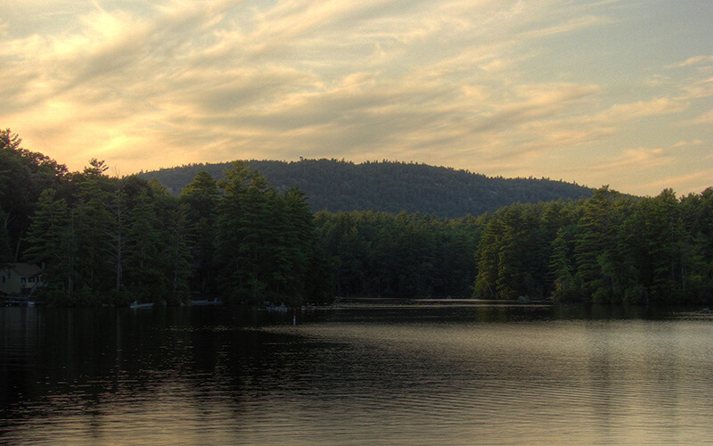
This 89-acre property in Deerfield and Nottingham provides access to a ledgy outcropping on the shore of Dead Pond with views up to the cliffs of Rocky Ridge, a section of the ancient ring dike that makes up the Pawtuckaway Mountains. Howard’s Path ascends easily along a woods road, heads straight through a clearing at 0.1 mile, and then dips to cross a causeway over a small inlet brook, with a view to a beaver pond on the right. The red-blazed trail swings right and makes a short, steep ascent to a lower junction with blue-blazed Quarry Trail at 0.3 mile. (A 0.4-mile alternate loop trail passes high above the beaver pond, with an old quarry and a small cave on the left, and then ascends easily along the north side of a minor ridge to rejoin Howard’s Path.)
Howard’s Path bears left at the Quarry Trail junction, swings left through an area of boulders, and then meanders at easy grades, passing a vernal pool on the right at 0.4 mile. At 0.5 mile it reaches the upper end of Quarry Trail. Here, Howard’s Path bears left and narrows into a footpath. It runs on bog bridges through a wet area—passing a large glacial boulder—climbs over a small rise, and then descends gradually through boulders to a ledgy area and granite bench on the shore of Dead Pond. Return to the trailhead by the same route.
Difficulty: Easy
Distance: 1.6 miles out and back
SOUTH MOUNTAIN TOWER TRAIL | Pawtuckaway State Park, Nottingham, N.H.
Probably the most popular hike in the park, this trail ascends South Mountain directly from the north and provides access to fine vistas from the fire tower and nearby ledges for a modest effort. The extensive views include Mount Wachusett, Mount Monadnock, Mount Sunapee, Lovewell Mountain, Mount Kearsarge, Blue Job Mountain, and Fort Mountain. The trail begins on Tower Rd. 0.8 mile north of Reservation Rd., just north of where an extension of Mountain Trail (also called Tower Trail Connector) leaves Tower Rd. (The 0.6-mile connector trail leads southwest to Mountain Trail; elevation gain 0 feet, rev. 50 feet.) South Mountain Tower Trail ascends by switchbacks through a pine grove on a white-blazed path; in the lower part there is a steep, direct route and a less steep, less direct route to the left. The trail passes several boulder caves (left) and the grade eases temporarily. Then the path ascends granite steps and climbs by switchbacks to the open ledges near the summit of South Mountain, where it reaches South Ridge Trail.
Difficulty: Easy
Distance: 0.8 mile out and back